 Cart(
Cart(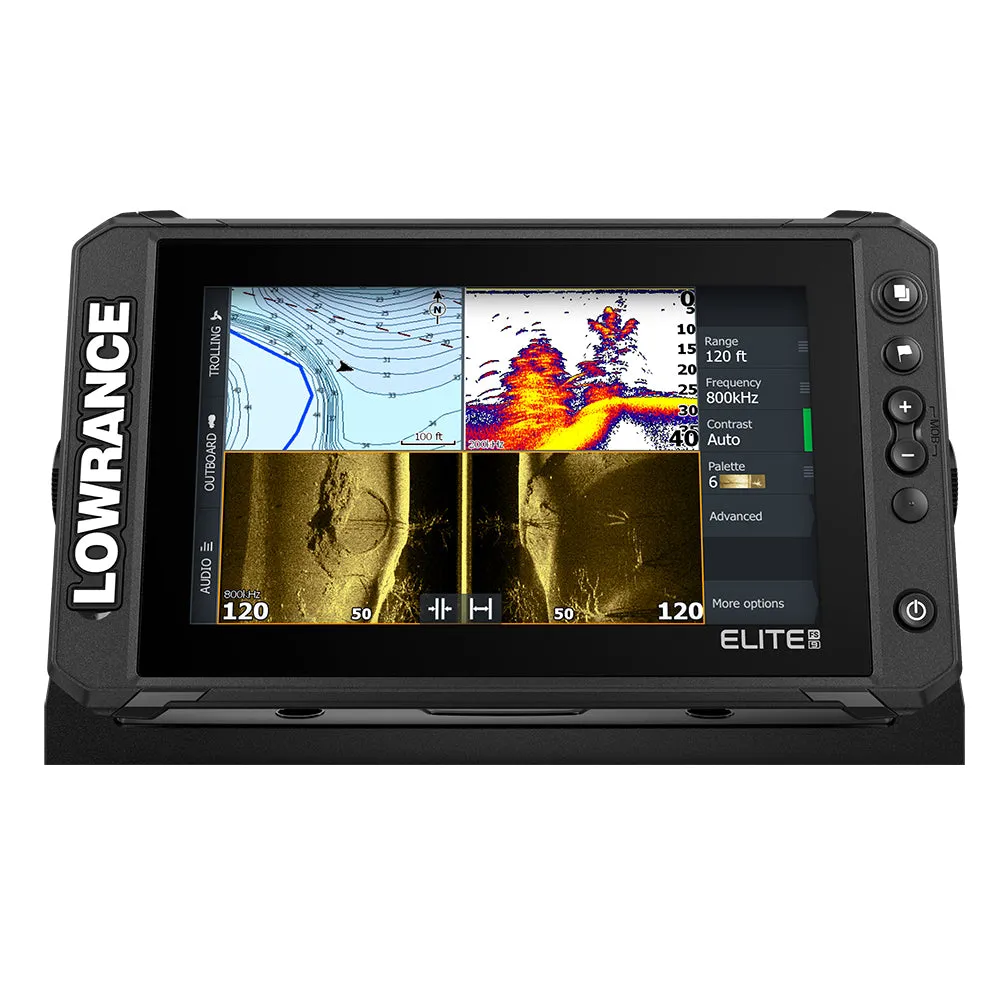
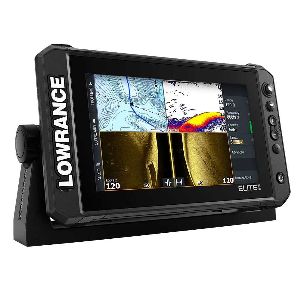
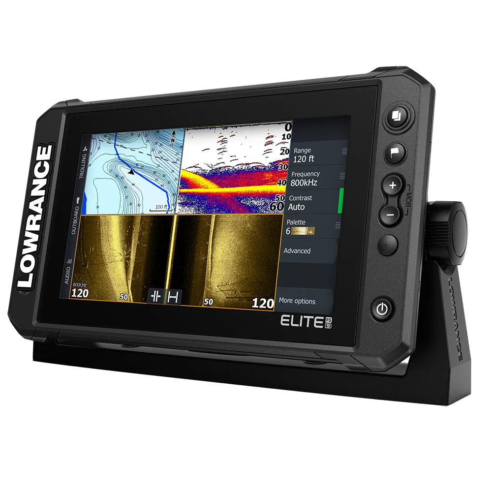
Elite FS 9 Chartplotter/Fishfinder with Active Imaging™ 3-in-1 Transom Mount Transducer
The Elite Fishing System (FS) combines the power of Lowrance’s proven and newest fishfinding tools with a more affordable display that’s easier to use and install. From ActiveTarget™ live sonar and extreme high-resolution Active Imaging™ with Lowrance CHIRP sonar, SideScan and DownScan Imaging™ to preloaded C-MAP® Contour Fishing Maps, Elite FS gives you all the tools you need to find and catch more fish.
Key Features
- 9" Display
- ActiveTarget™ Live Sonar ready with optional ActiveTarget™ live sonar and transducer (000-15593-001)
- Active Imaging™ 3-in-1 transom mount transducer included
- FishReveal™
- Preloaded C-MAP® Contour with 1-foot contours on 8,900 lakes
- Other mapping options including C-MAP, Navionics® and more
- C-MAP® Easy Routing, Navionics® Autorouting capability
- C-MAP Genesis Live onscreen mapping
- High-resolution multi-touch touchscreen
- Integrated wireless, NMEA 2000® and Ethernet connectivity
- Full touchscreen control of Power Pole® anchors and Ghost® Trolling Motor
C-Map Contour Mapping Preloaded
You will spend more time trying to catch fish and less time trying to find them with the high-resolution detail of the C-MAP Contour charts built into Elite FS displays. From finding key fishing areas, like ledges, drop-offs and ditches to navigating with precision to fish-holding areas, you will have more success on the water with high-resolution 1-foot contours on 8,900 lakes.
Key Features
- Custom depth shading
- Easy routing, Lowrance presentation for icons
- High-Resolution, Bathymetric 1-foot contours on 8,900 U.S. lakes
- Standard navigation data
- Fishing POIs


 Bottle")


![Furuno GP1971F 9" GPS/Chartplotter/Fishfinder 50/200, 600W, 1kW, Single Channel CHIRP [GP1971F]](https://www.drawspad.shop/image/furuno-gp1971f-9quot-gpschartplotterfishfinder-50200-600w-1kw-single-channel-chirp-gp1971f_zfGUJF_285x.webp "Furuno GP1971F 9\" GPS/Chartplotter/Fishfinder 50/200, 600W, 1kW, Single Channel CHIRP [GP1971F]")

